Yesterday I was able to take a side trip from Toledo to do some research at the Burton Historical Collection of the Detroit Public Library. On my way there I stopped to see the two-hundred year old remains of General William Hull's corduroy road, which once stretched from Urbana (north of Dayton, Ohio) to Detroit. These remains are visible on a embankment along West Jefferson Avenue after it crosses the Huron River south of Detroit. The site is very easy to find, perhaps only five minutes from I-75.
See the waymarking.com page for directions.
Full text of the marker:
Side 1: In April 1812, as the United States prepared for a
possible war with Great Britain, Michigans Territorial Governor William
Hull, became the commander of the Army of the Northwest. His first task
was to lead his army from Dayton, Ohio to Detroit, building Hulls Trace,
a two hundred mile long road, as it marched. The army left Dayton on
June 1. As it cut the trace through the wilderness from Urbana north, it
laid logs crosswise across swampy areas to create a rough but stable
corduroy roadbed that could support supply wagons. In late June, a
detachment from Frenchtown commanded by Hubert Lacroix also worked on
the road, attempting to follow a route laid out under an 1808
territorial Legislative Council act. On June 18, 1812, war was declared.
Hulls army arrived in Detroit on July 5.
Side 2: Hulls Trace, which linked Detroit and Ohio, was to be the
Michigan Territorys inland lifeline during the War of 1812. However, the
Detroit River and Lake Erie gave the British easy access to the
Michigan portion of the road. American efforts to use the road to bring
supplies and men from Frenchtown, present-day Monroe, were foiled twice
before Hull surrendered Detroit on August 16, 1812. After the war the
Hulls Trace route was used for ever-improving roads, beginning in 1817
with a new military road. In 2000 low water levels in the Huron River
revealed a quarter mile of the old corduroy road, lying three to six
feet beneath Jefferson Avenue. Axe marks were visible on some of the
logs. This rare example of a surviving corduroy road is listed in the
National Register of Historic Places.
 |
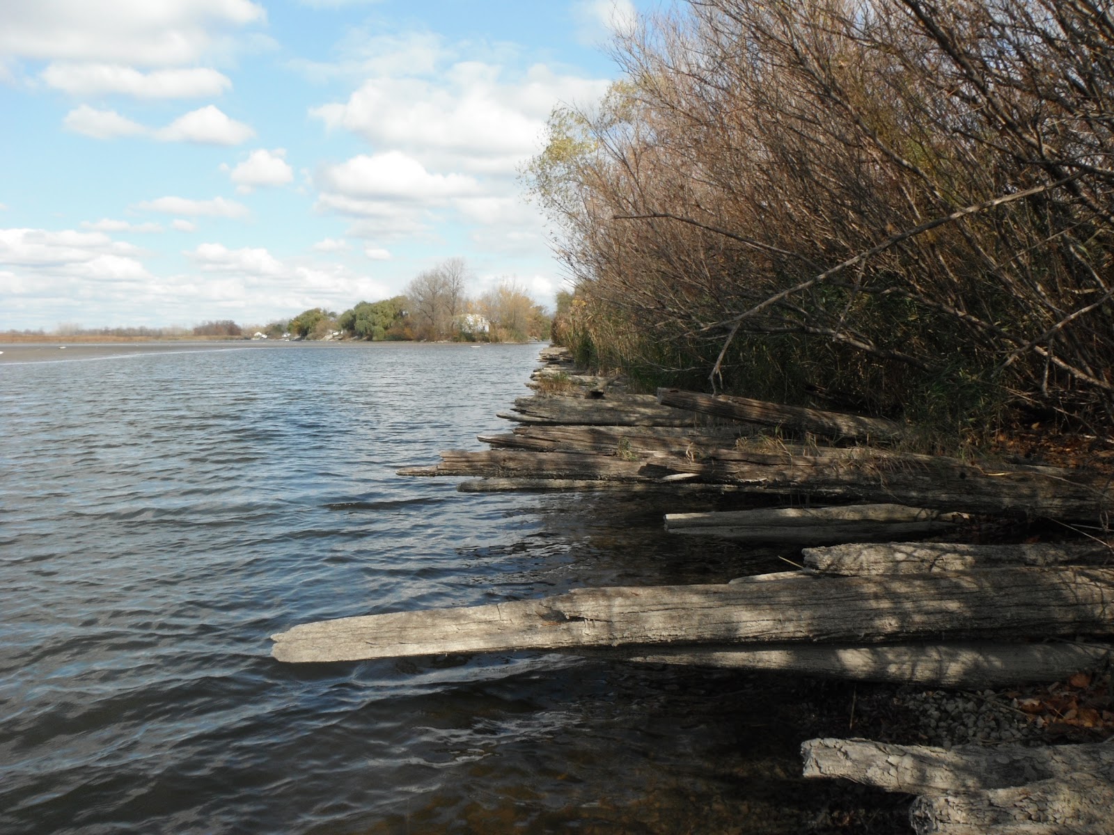
| Across the road from the sign, you have to peer through a thicket to glimpse the even rows of logs sticking out of the river bank. |
 |
| There is no trail or immediate access to the site from West Jefferson Ave... besides what you make for yourself. |
 |
| The logs themselves. |
 |
| This road bed was only inches from the waterline. Lake levels have gone down in recent years, and have uncovered the old road. |
 |
| View of the road stretching north to Detroit. |
 |
| Looking out towards the mouth of the Huron River, the Detroit River ship channel is in clear view. Any British ships could certainly have come in here to land troops or bombard the military road. |


No comments:
Post a Comment
Note: Only a member of this blog may post a comment.